• Welcome to AppraisersForum.com, the premier online  community for the discussion of real estate appraisal. Register a free account to be able to post and unlock additional forums and features.

All Solar, Et Al, In 12 Years?

Status
Not open for further replies.
Global Sea Ice Area Anomaly

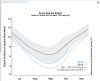
seaice.area.arctic.png


http://arctic.atmos.uiuc.edu/cryosphere/
 
Well, the largest hurricane every recorded is slamming Mexico tonight.
 
upload_2015-10-23_19-56-35.png


upload_2015-10-23_19-57-9.png

Antarctic sea ice appears to have reached its annual maximum extent on October 6. The maximum occurred relatively late compared to past years. In contrast to the past three years, the 2015 maximum did not set a new record high for the period of satellite observations, but was nevertheless slightly above the 1981 to 2010 average.
Antarctic sea ice extent reached its likely maximum for the year, at 18.83 million square kilometers (7.24 million square miles) on October 6, 2015. This year’s maximum was the sixteenth highest in the 35-year record. It was 120,000 square kilometers (46,000 square miles) above the average maximum daily extent computed over the 1981 to 2010 period of 18.71 million square kilometers (7.19 million square miles), and 1.33 million square kilometers (514,000 square miles) below the record maximum set in 2014. The date of the maximum was quite late in comparison to the 35-year satellite record. Only one year, 2002, has had a later maximum (October 12).

At the date of the 2015 maximum, Antarctic sea ice extent was greater than average in the Antarctic Peninsula region, the Weddell Sea, and the Wilkes Land coast area; and below average in the Ross Sea and Indian Ocean sectors.

As recently as July 12, Antarctic sea ice extent was at a record daily high extent for the satellite period of observations. For much of early 2015, Antarctic sea ice extent was either slightly above or slightly below the levels seen on the same date in 2014, the record high year. However, beginning in mid-July, the growth rate for Antarctic sea ice slowed significantly, causing the 2015 maximum extent to be only the sixteenth highest in the record.

It is likely that this slowing of late-winter ice growth is related in part to the build-up of the El Niño conditions. El Niño occurs when a large area of the surface waters in the tropical eastern Pacific Ocean warms, and it has widespread effects on weather patterns. In the Southern Ocean, El Niño conditions are typically associated with a weakening of the Amundsen Sea Low, a persistent region of low air pressure in the southernmost Pacific sector of the Antarctic coast (Raphael et al., 2015). Air pressure in the Amundsen Sea region for the months of August and September was higher than average, indicating a weakening of the low-pressure tendency in the region. Higher-than-average air pressure was also observed in the Indian Ocean sector. These regions saw reduced sea ice growth and even local sea ice retreat as the austral winter progressed, and areas of higher-than-average temperatures near the ice edge.

Patterns of sea ice concentration around Antarctica (the deviation from average ice concentration) for El Niño years show a similar pattern, with more ice near the Peninsula

http://nsidc.org/arcticseaicenews/

 

Well, NBC news says it's the biggest ever with 200 mile an hour winds.

Hurricane Patricia: Strongest Storm Ever Measured to Hit Mexico

Hurricane Patricia became the strongest storm ever measured on the planet early Friday, with experts warning it could trigger 40-foot waves along southwestern Mexico and "life-threatening" flash flooding.

More than 7 million residents — and an estimated tens of thousands of U.S. citizens visiting or living there — were told to prepare for the "worst-case scenario" as the ferocious storm was expected to race ashore on Mexico's Pacific coast between 6 to 10 p.m. ET Friday.

At 5 p.m. ET, Patricia was about 60 miles west of Manzanillo, and about 110 miles south-southeast of Cabo Corrientes.

advertisement

The U.S. National Hurricane Center said Patricia was expected to make landfall "in the next several hours." A hurricane warning was in place for San Blas to Punta San Telmo.

The tourist magnets of Puerto Vallarta and Manzanillo were directly in the Category 5 storm's projected path, and Puerto Vallarta's airport was closed Friday out of precaution as some stranded vacationers described their inability to fly out of a "nightmare."

By 5 p.m. winds had weakened slightly to 190 mph, the Hurricane Center said. Winds of 200 mph were measured earlier, and the Hurricane Center labeled Patricia as the "strongest hurricane on record" in the Atlantic and eastern North Pacific Basins.

Mexico has not formally requested help from the U.S., but State Department spokesman Mark Toner told reporters Friday that America "stands up to offer any assistance that we can in the aftermath of what at least appears to be a pretty epic event in terms of the intensity and size of the storm."
http://www.nbcnews.com/news/weather...ces-toward-mexico-coast-200-mph-winds-n449731


.
 
Gee, antarctica has global cooling and if you want to argue, the arctic has global warming.
 
View attachment 27240


View attachment 27241

Antarctic sea ice appears to have reached its annual maximum extent on October 6. The maximum occurred relatively late compared to past years. In contrast to the past three years, the 2015 maximum did not set a new record high for the period of satellite observations, but was nevertheless slightly above the 1981 to 2010 average.
Antarctic sea ice extent reached its likely maximum for the year, at 18.83 million square kilometers (7.24 million square miles) on October 6, 2015. This year’s maximum was the sixteenth highest in the 35-year record. It was 120,000 square kilometers (46,000 square miles) above the average maximum daily extent computed over the 1981 to 2010 period of 18.71 million square kilometers (7.19 million square miles), and 1.33 million square kilometers (514,000 square miles) below the record maximum set in 2014. The date of the maximum was quite late in comparison to the 35-year satellite record. Only one year, 2002, has had a later maximum (October 12).

At the date of the 2015 maximum, Antarctic sea ice extent was greater than average in the Antarctic Peninsula region, the Weddell Sea, and the Wilkes Land coast area; and below average in the Ross Sea and Indian Ocean sectors.

As recently as July 12, Antarctic sea ice extent was at a record daily high extent for the satellite period of observations. For much of early 2015, Antarctic sea ice extent was either slightly above or slightly below the levels seen on the same date in 2014, the record high year. However, beginning in mid-July, the growth rate for Antarctic sea ice slowed significantly, causing the 2015 maximum extent to be only the sixteenth highest in the record.

It is likely that this slowing of late-winter ice growth is related in part to the build-up of the El Niño conditions. El Niño occurs when a large area of the surface waters in the tropical eastern Pacific Ocean warms, and it has widespread effects on weather patterns. In the Southern Ocean, El Niño conditions are typically associated with a weakening of the Amundsen Sea Low, a persistent region of low air pressure in the southernmost Pacific sector of the Antarctic coast (Raphael et al., 2015). Air pressure in the Amundsen Sea region for the months of August and September was higher than average, indicating a weakening of the low-pressure tendency in the region. Higher-than-average air pressure was also observed in the Indian Ocean sector. These regions saw reduced sea ice growth and even local sea ice retreat as the austral winter progressed, and areas of higher-than-average temperatures near the ice edge.

Patterns of sea ice concentration around Antarctica (the deviation from average ice concentration) for El Niño years show a similar pattern, with more ice near the Peninsula

http://nsidc.org/arcticseaicenews/


NSIDC%20GlobalArcticAntarctic%20SeaIceArea.gif


What do you make of it?
 
It just seems to me that if,

The planet is getting warmer because of carbon emissions from human activity since 1900, then,

2014 should not have been the year with the largest amount of artic ice.

Unless somebody is lying.

.
 
Status
Not open for further replies.
Find a Real Estate Appraiser - Enter Zip Code

Copyright © 2000-, AppraisersForum.com, All Rights Reserved
AppraisersForum.com is proudly hosted by the folks at
AppraiserSites.com
Back
Top