If you're talking about making maps or marking up assessor plats then you can just print to a pdf and use the markup tools in Adobe or whatever PDF editor you use. For assessor maps I use the polygon tool set to a 50% transparency.
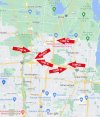
For street maps I use the online maps at the cities or counties and their own internal markup tools. If I'm working in a county or city that doesn't have that combo I just use the L.A. County Dept. of Regional Planning map tool (Z-Net) , which a couple of their base maps cover the entire country and which also has internal markup tools. The map below isn't even located in L.A. County - it's in Orange County.
View attachment 72570